


Fuerte temporal en camino: ocho avisos por tormentas con lluvias intensas y caída de granizo
El fenómeno afectará a cuatro provincias, con ráfagas que podrían superar los 90 km/h y acumulados importantes de precipitación.
AVISO METEOROLÓGICO
TORMENTAS FUERTES CON LLUVIAS INTENSAS, RAFAGAS Y OCASIONAL CAIDA DE GRANIZO.
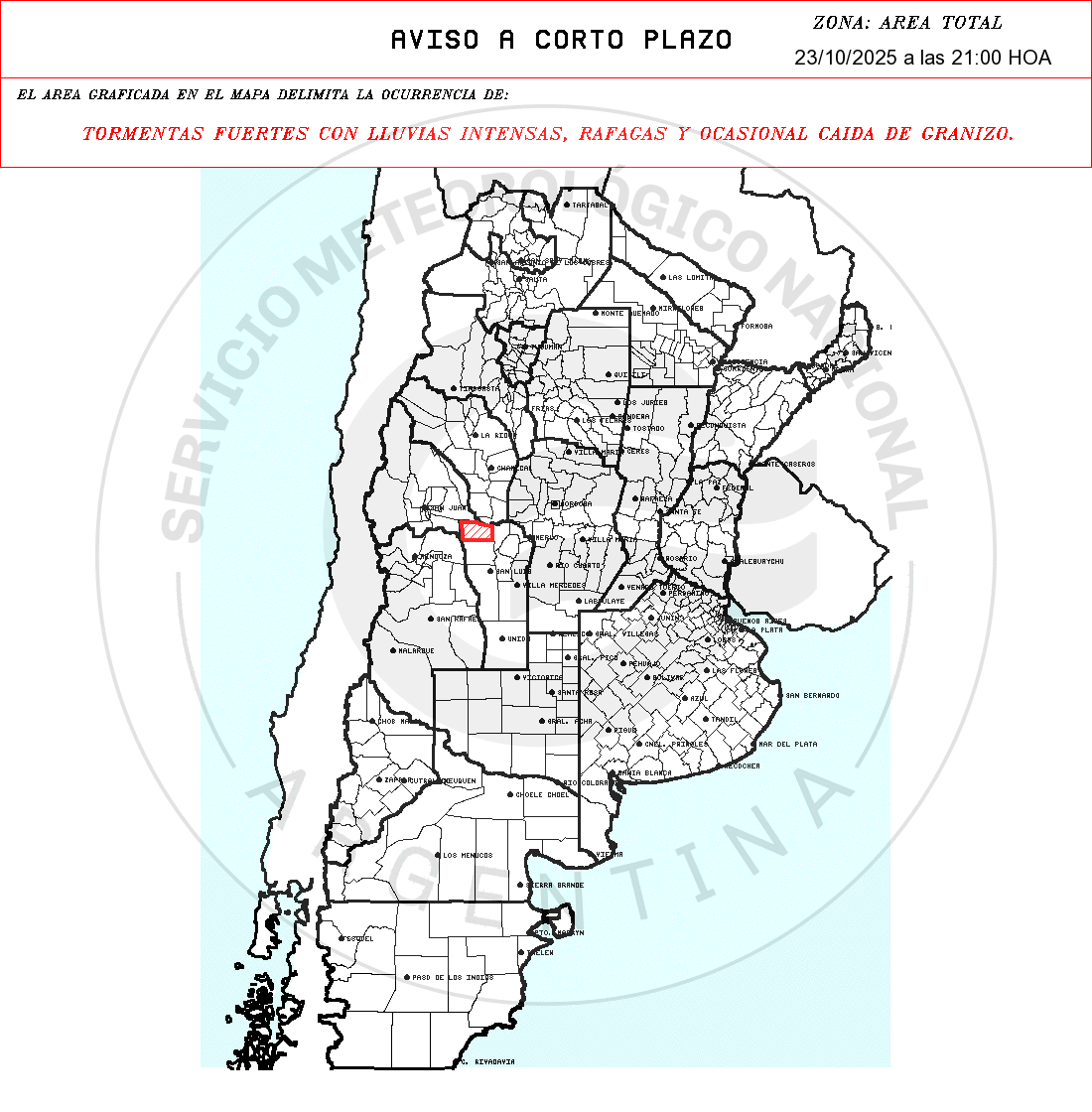
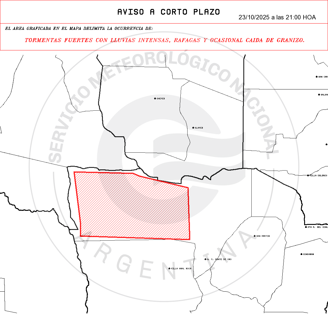
- Zonas: SAN LUIS: Ayacucho.
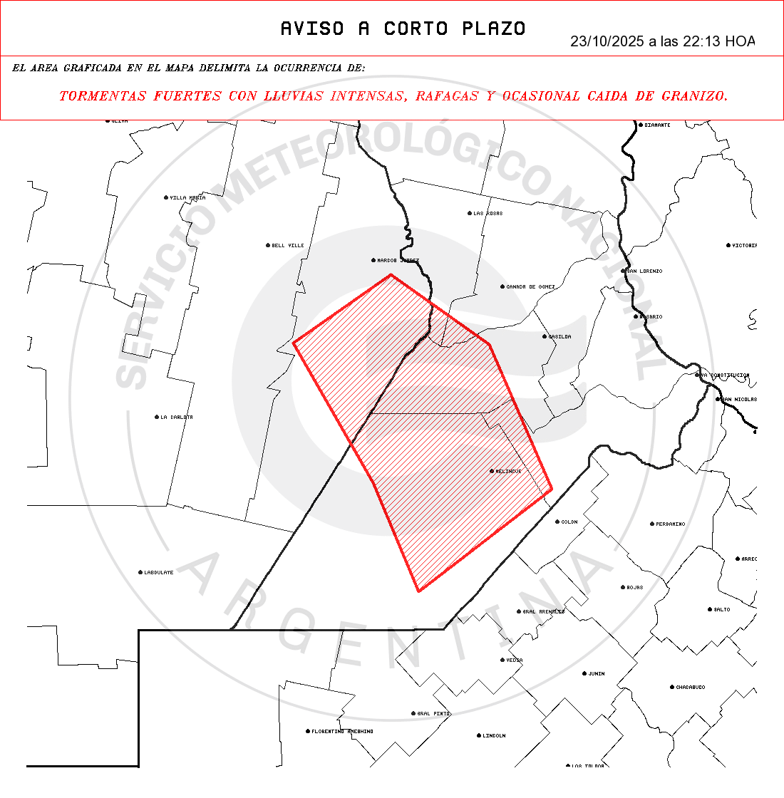
AVISO METEOROLÓGICO
TORMENTAS FUERTES CON LLUVIAS INTENSAS, RAFAGAS Y CAIDA DE GRANIZO.
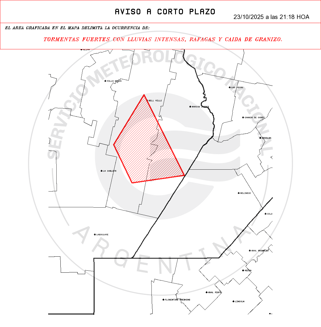
- Zonas: CORDOBA: Marcos Juárez – Unión.

Te puede interesar
- Pronóstico de lluvias hasta el 3 de noviembre
“Argentina compite con una mano atada”: el agro nacional paga más y gana menos
- La CNTA fijó nuevas escalas salariales para el trabajador rural: aumentos escalonados hasta 2026
Trump analiza aumentar las importaciones de carne argentina para contener los precios en EE.UU.
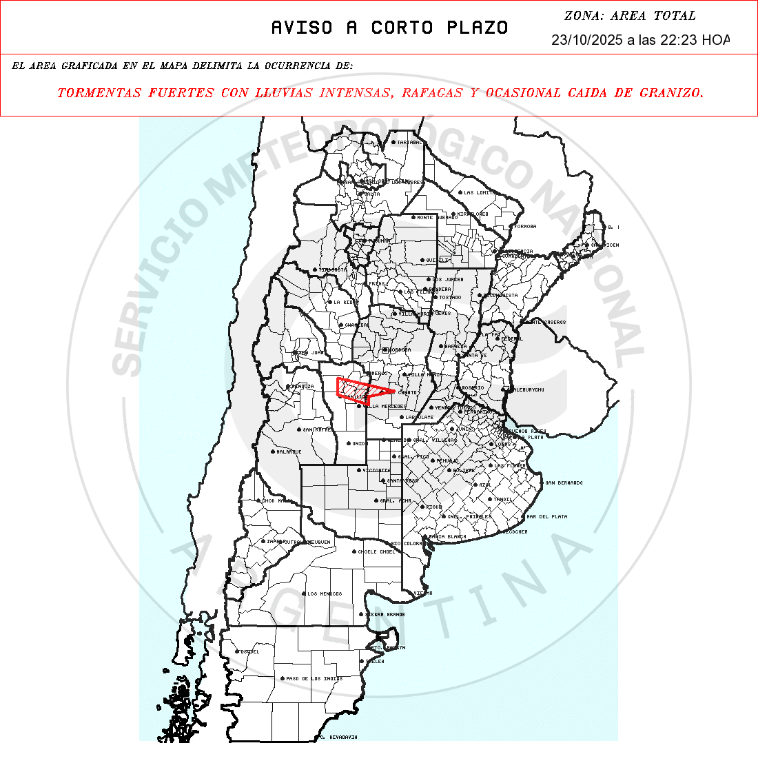
AVISO METEOROLÓGICO
TORMENTAS FUERTES CON LLUVIAS INTENSAS, RAFAGAS Y OCASIONAL CAIDA DE GRANIZO.
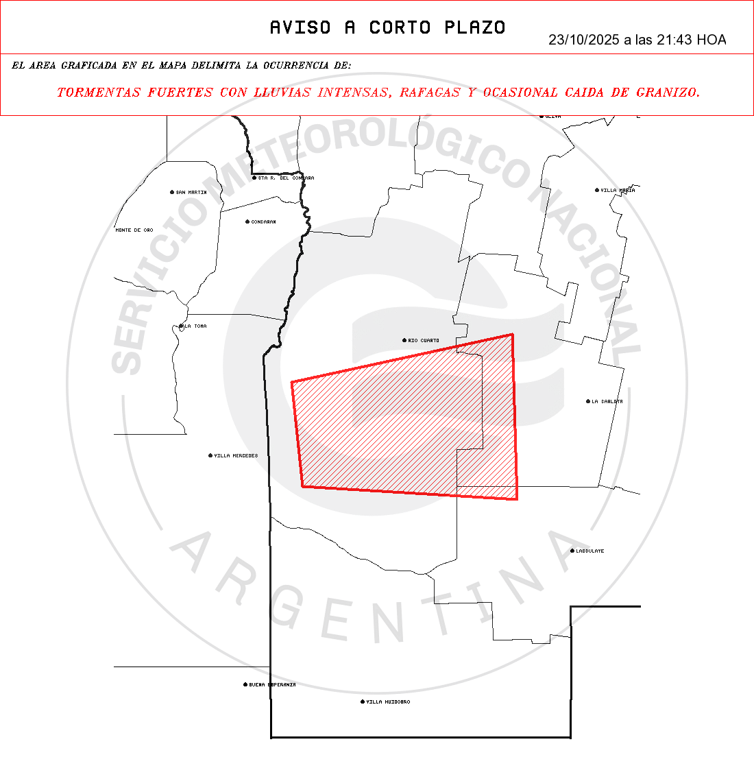
- Zonas: CORDOBA: Juárez Celman – Pres Roque S. Pena – Rio Cuarto.

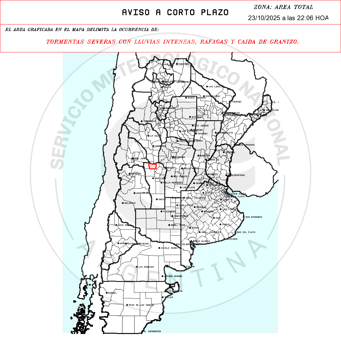
AVISO METEOROLÓGICO
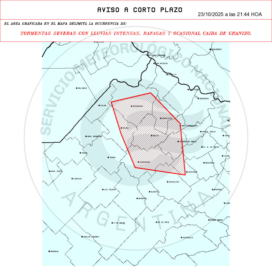
TORMENTAS SEVERAS CON LLUVIAS INTENSAS, RAFAGAS Y OCASIONAL CAIDA DE GRANIZO.
- Zonas: BUENOS AIRES: Arrecifes – Cap Sarmiento – Carmen de Areco – Chacabuco – Chivilcoy – Pergamino – Rojas – S. A. de Giles – Salto – Suipacha.

AVISO METEOROLÓGICO
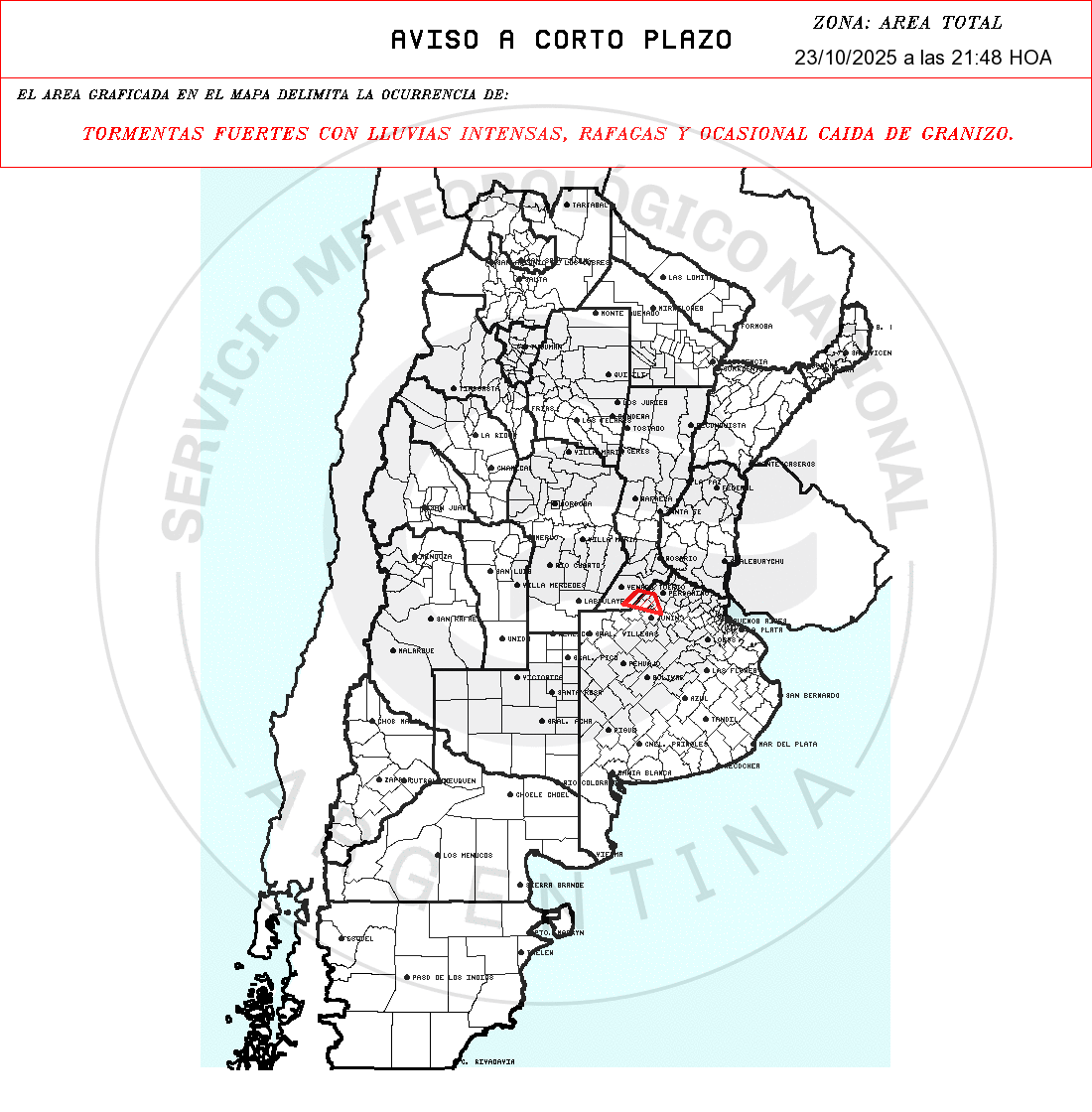
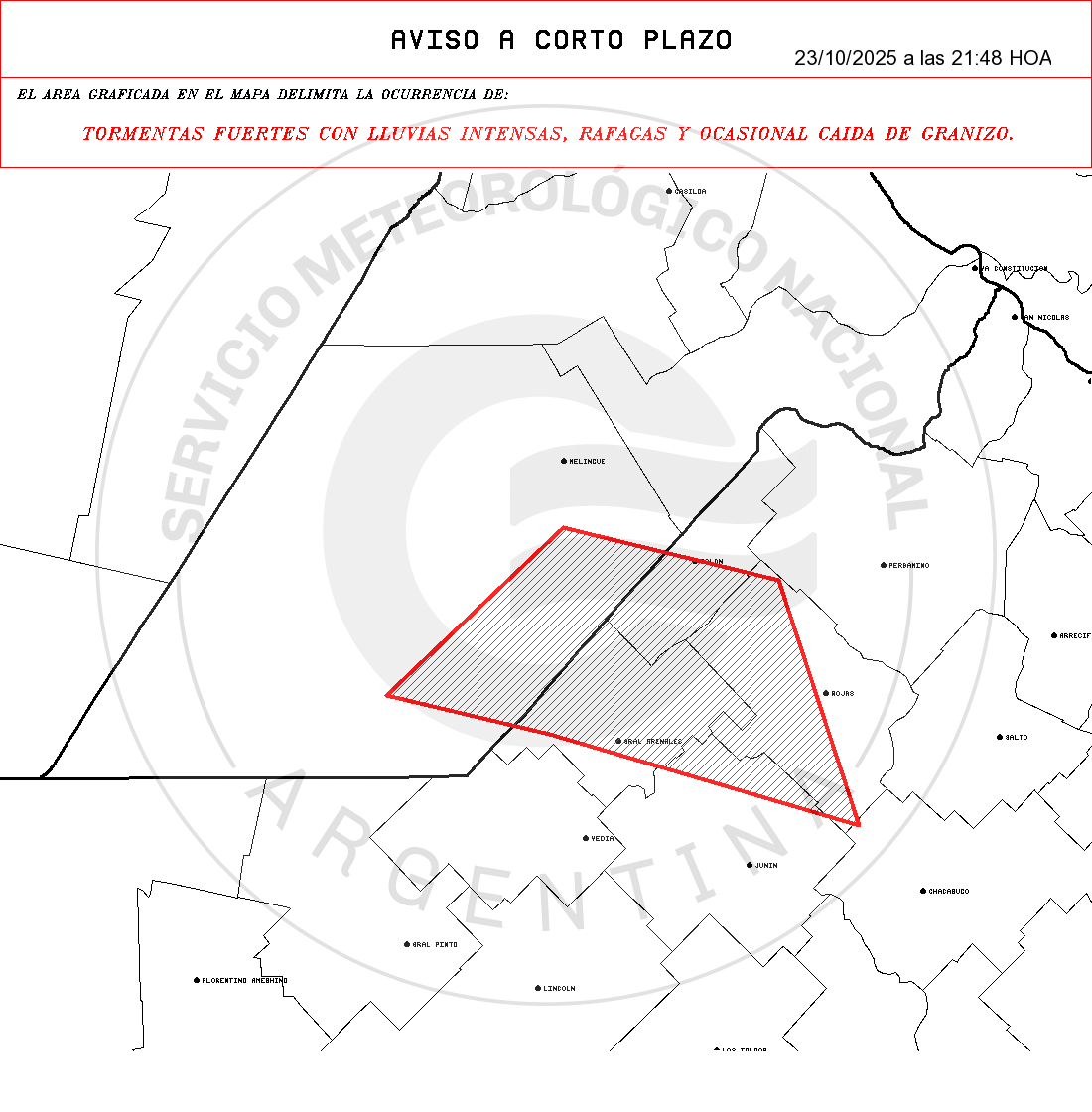
TORMENTAS FUERTES CON LLUVIAS INTENSAS, RAFAGAS Y OCASIONAL CAIDA DE GRANIZO.
- Zonas: SANTA FE: Gral López.
BUENOS AIRES: Colon – Gral Arenales – Junín – Rojas.
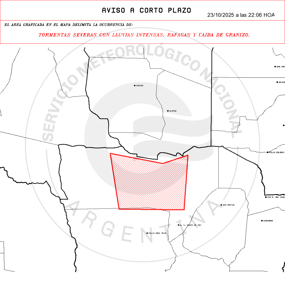
AVISO METEOROLÓGICO
TORMENTAS SEVERAS CON LLUVIAS INTENSAS, RAFAGAS Y CAIDA DE GRANIZO.
- Zonas: SAN LUIS: Ayacucho.
AVISO METEOROLÓGICO
TORMENTAS FUERTES CON LLUVIAS INTENSAS, RAFAGAS Y OCASIONAL CAIDA DE GRANIZO.
- Zonas: SANTA FE: Belgrano – Caseros – Constitución – Gral López – Iriondo.
CORDOBA: Marcos Juárez.

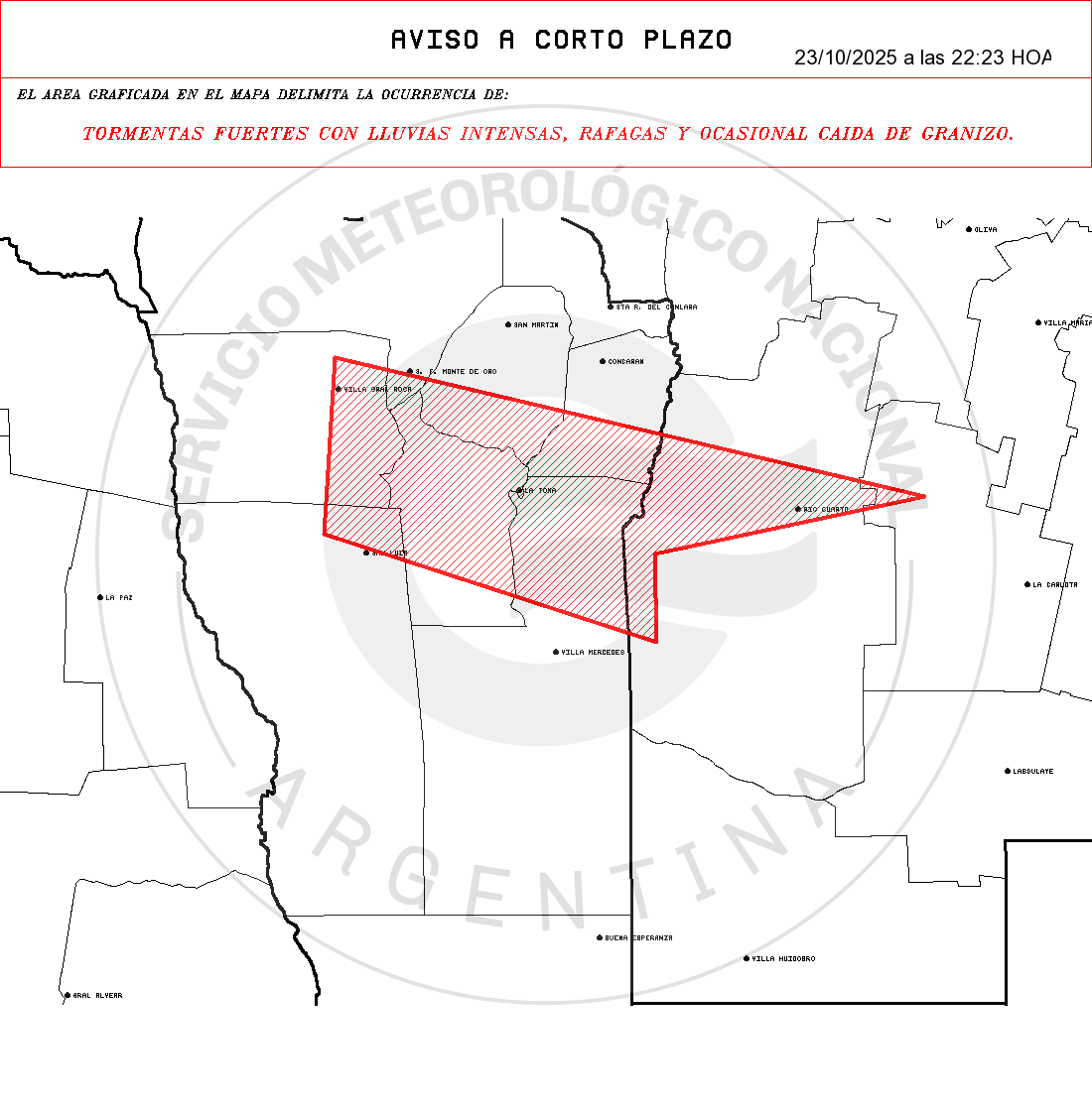
AVISO METEOROLÓGICO
TORMENTAS FUERTES CON LLUVIAS INTENSAS, RAFAGAS Y OCASIONAL CAIDA DE GRANIZO.
- Zonas: CORDOBA: Juárez Celman – Rio Cuarto.
SAN LUIS: Ayacucho – Belgrano – Chacabuco – Cnel Pringles – Gral Pedernera – Juan M. de Pueyrredón – Ldor Gral San Martin.
AVISO METEOROLÓGICO
TORMENTAS FUERTES CON LLUVIAS INTENSAS, RAFAGAS Y OCASIONAL CAIDA DE GRANIZO.
- Zonas: SAN LUIS: Ayacucho.

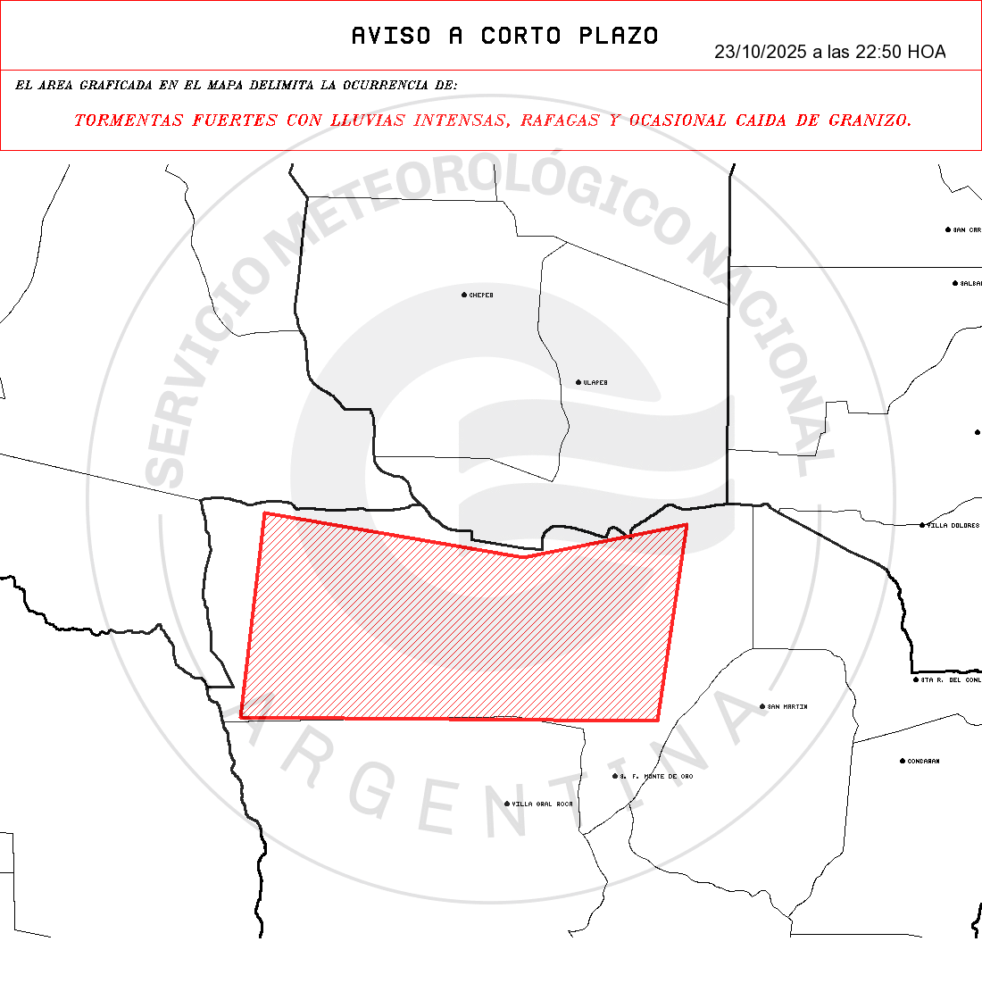
- Fecha de emisión: 23/10/2025 a las 22:50h.
- Validez hasta: Una (1) hora desde la emisión.
- Medidas de protección:
1- Permanecé en construcciones cerradas como casas, escuelas o edificios públicos.
2- Mantenete alejado de artefactos eléctricos y evitá el uso de teléfonos con cable.
3- Evitá circular por calles inundadas o afectadas.
4- Si hay riesgo de que el agua ingrese en tu casa, cortá el suministro eléctrico.
5- Evitá actividades al aire libre.
6- Para minimizar el riesgo de ser alcanzado por un rayo, no permanezcas en playas, ríos, lagunas o piletas.
Fuente: Servicio Meteorológico Nacional